RiaLogger - low-cost tool for acquiring measurements in remote locations
Collecting geophysical data from water environments in remote or inaccessible locations is usually a logistically taxing and costly task. Small and instrumented buoys can provide a relatively low-cost tool for acquiring measurements either from remote locations in the open ocean or in continental environments such as lakes at high altitudes, ponds in salt marshes and mud flat in estuarine regions. The objective of RiaLogger has been to develop micro buoys that can be deployed from aerial platforms to simplify the entire operation.
A prototype system was developed to study hydrographic properties of water bodies located in inaccessible regions of estuaries or coastal lagoons, such as Ria de Aveiro Lagoon in north-western Portugal.
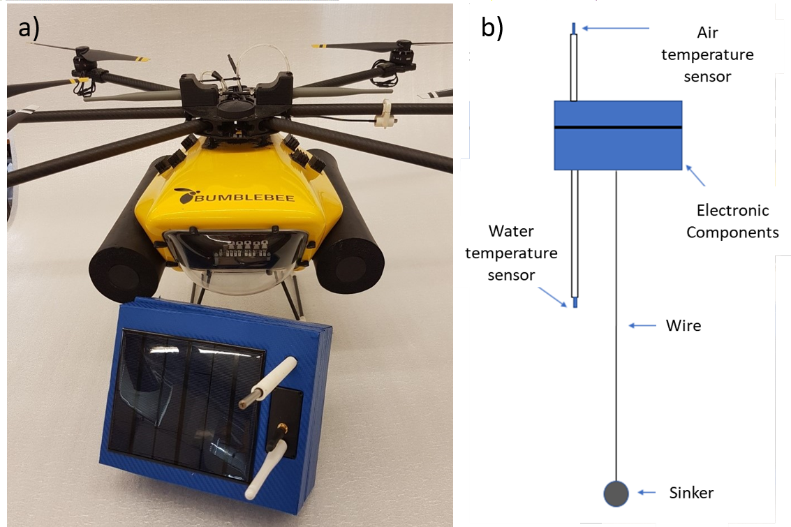
The system was designed with the aim of being able to log temperature for 15 consecutive days to cover at least one fortnightly tidal cycle. Wireless connectivity is periodically enabled for data communication. To deploy the micro-buoy, a small hexacopter vehicle with the autonomous capability to arrive at the desired location and deploy the buoy payload was employed. The payload is attached to the vehicle under its belly to a simple servo motor which is then actuated once the system arrives at desired deploy location. Furthermore, the UAS is not only used to deploy the micro-buoy, but is also used to collect the data via a Wi-Fi link to the buoy.
References:
- M. Ribeiro et al., "Development and deployment of an estuarine microbuoy," OCEANS 2018 MTS/IEEE Charleston, Charleston, SC, USA, 2018, pp. 1-5.